
In this article
Start with the park’s current road information
Open Yosemite Current Conditions, find Road Status, and read the row labeled Tioga Road. NPS identifies it as the continuation of Highway 120 through the park. Do not substitute the row for Big Oak Flat Road: that is another part of the approach, and its status does not establish that the high-country crossing is available.
The instruction immediately above the table matters as much as the status cell. NPS directs visitors to 209-372-0200, then 1, then 1, for the most up-to-date conditions. It says the website table reflects planned or long-term closures. A website observation is therefore useful planning evidence, rather than a live assurance that you can drive through at your arrival time.
| Dated source observation | What it showed and establishes |
|---|---|
| NPS Current Conditions, Tioga Road row, October 29 | Open, with no overnight parking along the road or parking lots. This is the status displayed in that park table when checked. |
| NPS seasonal opening update | A May 13 announcement of opening to all traffic on May 15 at 8 am. This establishes the announced start of the 2026 season. |
| Caltrans SR 120 report, October 28 capture | No restrictions reported for the central California and Sierra Nevada area, with a separate instruction to call Yosemite. Its highway report has an explicit park-specific boundary. |
The table is a dated source comparison, not an automatically refreshed road report. Reopen the sources when making a travel decision.
Separate the seasonal opening from a temporary closure
The NPS plowing and opening page records the 2026 seasonal announcement. Its May 13 update says vehicle access would begin May 15, with bicycle access May 14. Those are different access dates. Neither is a promise that the road stays open without interruption for the rest of the year.
NPS describes the usual vehicle season as late May or June until sometime in November. That is a general pattern, not a fixed closing date. The same page explains that clearing snow is only part of reopening: crews also address hazards, facilities and essential services. A photograph of a cleared stretch cannot establish that the full road has opened to public traffic.
This distinction also prevents a common search mistake. A result titled “Tioga Pass is open” can describe a spring announcement, an earlier storm reopening or a previous year. Read the publication date and the event date separately. An article refreshed by a search engine today may still describe what happened months ago.
Video: FlyingDawnMarie, published May 18, 2026, with footage dated May 11–15. The Tioga Road chapter begins at 1:41. This independent travel creator’s opening-week footage provides seasonal context; it is not an NPS report or evidence of October access.
Check both Highway 120 and the park segment
Use Caltrans’s SR 120 report for the highway information it actually publishes. During our capture, its report was timestamped October 28, 2026, at 3:04 am and stated that no restrictions were reported for its central California and Sierra Nevada area. The separate Yosemite section directed readers to the park phone number.
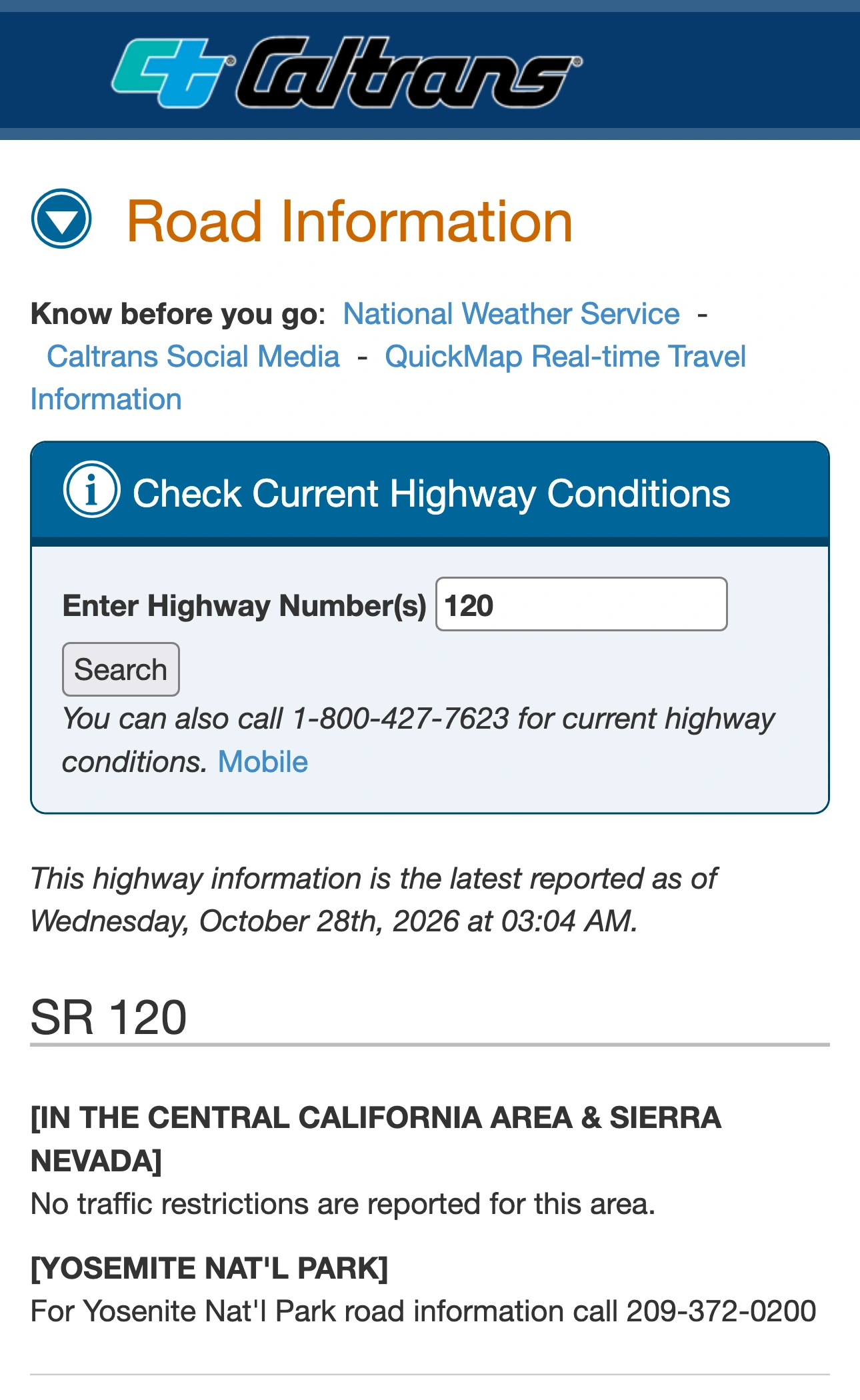
Source: Caltrans Road Information, SR 120, captured October 28, 2026. The regional report and separate park instruction have different scopes; the screenshot is a dated observation, not a live road-status feed.
That wording should not be expanded into a guarantee about every road, parking area or service inside Yosemite. It is a source with a defined scope. Likewise, a park row marked Open does not tell you that an unrelated connecting highway is unrestricted. Match the road segments in your intended route to the appropriate official reports.
Caltrans QuickMap is another native reference linked from the highway report. Use these official tools before adding a separate monitor. For park access, follow the NPS instruction to check its current phone information rather than inferring access from a search summary or an old scenic drive.
Resolve conflicting search answers at the source
Our October 28 check found a concrete disagreement. Google’s answer for “is Tioga Pass open” described a temporary closure beginning October 21. The official NPS table we opened displayed Open. A different search, about the opening date, summarized the May opening announcement instead.
These observations concern that search session; they do not establish how every reader’s results appear. They do show why the query, source and date need to stay together. The seasonal announcement, a storm notice and the current table answer different questions.
When results disagree, use this sequence:
- Confirm that the result concerns Tioga Road through Yosemite, rather than another mountain pass.
- Open the original source and identify the date of the event it describes.
- Read the current park table and its limitation, rather than only the status word.
- Check the official park phone information before relying on access for your journey.
For a booking question, our Yosemite camping reservation guide covers a separate task. A campsite reservation does not itself answer whether your chosen road approach is open.
Follow one published status between planning checks
If you are planning ahead and repeatedly reopening the same page, PageDog can watch a selected visible area locally on your Mac. On the NPS page, choose only the Tioga Road label, status and associated restriction text. A goal such as “Notify me when this Tioga Road row changes from Open to a closure notice” keeps the watch tied to one observable statement.
This monitors what the page publishes. It cannot discover an unreported closure, call the park, inspect the road or certify driving conditions. Keep the Mac running for checks, and return to the official sources when the result matters. PageDog is useful for noticing a published planning change, not for replacing the park’s current travel information.
Selecting the whole conditions page would also include unrelated campground, air-quality and trail updates. Our guide to reducing false website-change alerts explains why a smaller area and an exact condition are usually easier to interpret. Confirm the selected evidence still contains the road name so that a nearby row cannot be mistaken for Tioga Road.
The practical rule is simple: use the official tools to answer the immediate access question, distinguish seasonal history from current status, and use an optional page watch only to notice a later published change while planning.
Research sources
NPS Current Conditions, NPS Tioga opening updates, and Caltrans SR 120.